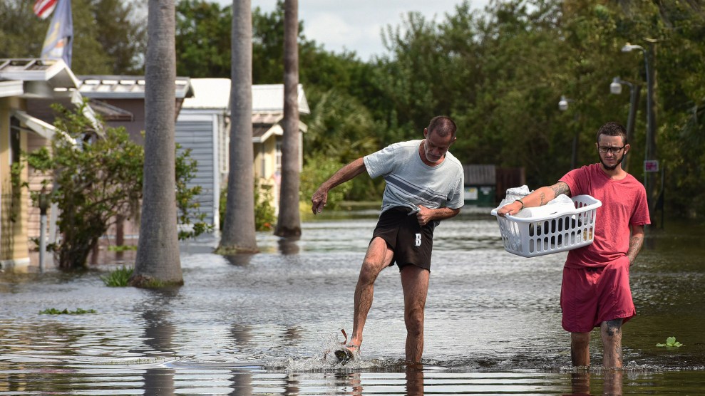
Flooding in Florida after Hurricane Ian.Paul Hennessy/SOPA Images/Zuma
This story was originally published by Inside Climate News and is reproduced here as part of the Climate Desk collaboration.
Get ready for an active hurricane season. The National Oceanic and Atmospheric Administration is predicting the greatest number of named storms this hurricane season since the forecasts began in 1998.
NOAA expects above-normal hurricane activity this season, with 17 to 25 named storms including eight to 13 hurricanes and four to seven major hurricanes of category 3, 4 or 5 strength, packing winds of 111 miles an hour or more. The federal agency based its unprecedented forecast on a confluence of factors, most notably near-record sea surface temperatures that are as warm now as they normally are in August.
“That forecast is the greatest number of storms that we’ve forecast,” said Ken Graham, director of the National Weather Service. “Now is the time to prepare.”
The average season features 14 named storms including seven hurricanes and three major hurricanes, according to NOAA. The season begins June 1 and ends Nov. 30.
There is an 85 percent chance for an above-normal season, and “it only takes one storm to devastate a community.”
“This season is looking to be an extraordinary one,” said Rick Spinrad, administrator of NOAA. “Remember it only takes one storm to devastate a community.”
NOAA said the sea surface temperatures were poised to power more storms. Forecasters also based their predictions on what they anticipate will be a quick transition to La Niña conditions, leading to a decrease in wind shear or atmospheric choppiness that can weaken or break apart storms. They also cited the potential for an above-normal African monsoon, which can produce African easterly waves that seed the strongest and longer-lived storms.
The federal agency said there was an 85 percent chance for an above-normal season, 10 percent chance for a near-normal season and five percent chance for a below-normal season.
The forecast was consistent with others. Forecasters at Colorado State University also predicted an “extremely active” season, with 23 named storms including 11 hurricanes and five major hurricanes. At the University of Pennsylvania, forecasters expected 33 named storms. The most named storms ever recorded during a single hurricane season was 30 in 2020.
“We’re not forecasting the most active season on record but certainly a hyper-active season,” said Phil Klotzbach, a senior research scientist in the Department of Atmospheric Science at Colorado State University.
The Colorado State forecasters said there was a 62 percent chance of a major hurricane striking the U.S., with a 34 percent chance of one of the storms making landfall along the East Coast, including the Florida peninsula, and 42 percent chance along the Gulf Coast. They also said there was a 66 percent chance of a major hurricane tracking through the Caribbean.
This activity would be well above the average from 1991 to 2020. The Colorado State forecasters issued their predictions with above-normal confidence, in contrast to last year when an unusual confluence of factors created more uncertainty than normal. That year warm sea surface temperatures were expected to enhance activity, but a developing El Niño pattern, it was thought, would temper that activity.
“We’ve never seen anything like this, and it just keeps going up and it’s not even returning to the 2023 record.”
“This year pretty much everything is pointing in the same direction,” Klotzbach said. “There’s not a lot of seasons where everything is pointing in the same direction.”
The sea surface temperatures are tracking even hotter than at this time last year, when an unprecedented marine heat wave led to triple-digit temperatures in the Florida Keys over the summer and widespread coral bleaching, said Brian McNoldy, senior research associate in the Rosenstiel School of Marine, Atmospheric, and Earth Science at the University of Miami.
Recently, temperatures across a swath of the Atlantic known as the Main Development Region, for the frequency of hurricanes that form here, have averaged 82.5 degrees Fahrenheit, he said. Normally at this time of year the average temperature is 78.5 degrees.
“It’s insane. It’s blowing past any of the other records that were recently set,” McNoldy said. “2023 and now 2024 don’t look like previous years anymore. They’re just so far above anything. So I don’t think it’s just climate change.”
Experts say trade winds across the Atlantic have been weaker than normal, leading to less water evaporation and mixing that can cool water temperatures. Also there have been fewer plumes of Saharan dust blowing across the Atlantic, which can help shield sunlight.
“We’ve never seen anything like this, and it just keeps going up and it’s not even returning to the 2023 record, which was outlandish,” McNoldy said. “We’re all kind of watching this in shock.”
David Zierden, Florida’s state climatologist based in the Center for Ocean-Atmospheric Prediction Studies at Florida State University, pointed out that while hurricane forecasting has improved, it remains difficult to predict where the storms might track.
“These seasonal outlooks can’t forecast where these storms might occur or where they might make landfall,” he said. “So we have to be equally prepared about any year.”