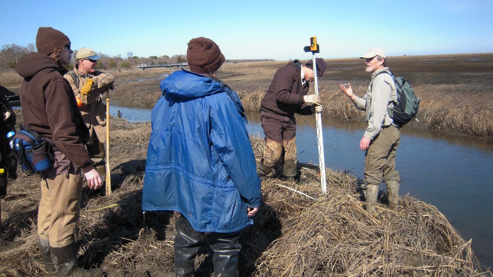
Professor David Burdick and his students measure potential sea level changes.Bill Butcher/USFWS/Wikimedia Commons
This story was originally published by Hakai Magazine and is reproduced here as part of the Climate Desk collaboration.
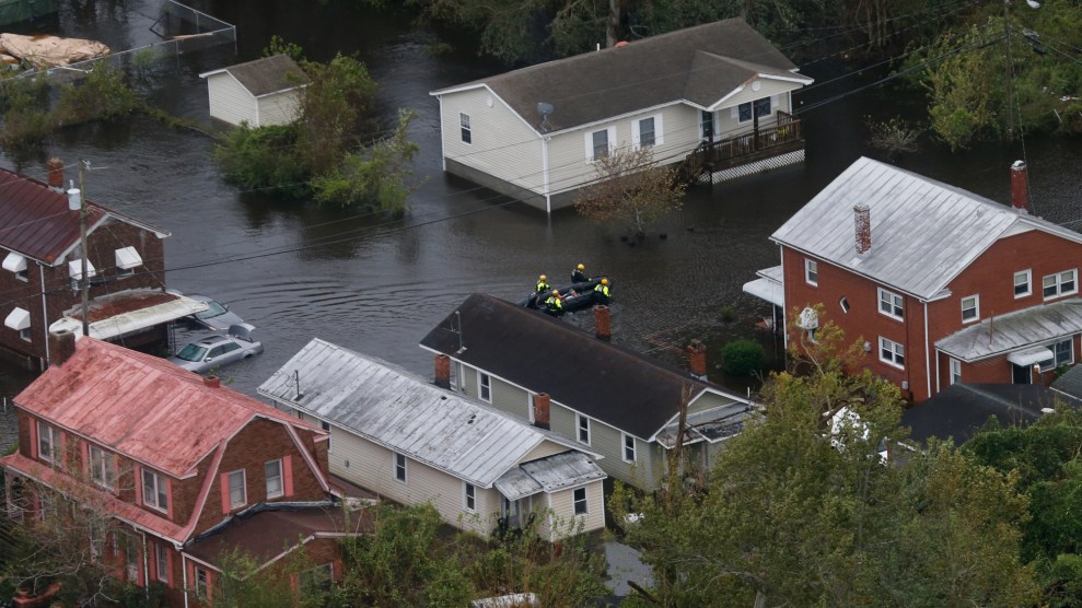
Around the world, communities are bracing for sea level rise: the Netherlands is stabilizing its dikes, Senegal is relocating neighborhoods, and Indonesia is moving its entire capital city. These projects are hefty, expensive, and slow.
But they may need to pick up the pace. As new research shows, in many places, sea level rise will cause coastal flooding and other disruptions much sooner than anyone realized. It’s not that the water is rising faster; it’s that the land was lower to begin with.
Calculating when a rising sea will flood any one place involves a lot of math: you need to know the height of the water, the range of the tide, the elevation and slope of the land, the pace of sea level rise, and how much the land itself is rising or falling, among myriad other factors. As with all of science, the accuracy of these predictions is only as good as the data flowing into them.
The problem, according to the new study by Ronald Vernimmen and Aljosja Hooijer, two data analysts working on flood risk in Southeast Asia, is that time after time, the measurements of coastal elevation that scientists feed into their models have been wildly inaccurate. In tropical forests, says Vernimmen, these misinterpretations can be off by 20 meters or more. “Obviously, you can’t use that,” he says.
The problem stems from limitations in the technology typically used to measure elevation: radar. Radar blankets an area in radio waves, then measures how long it takes the waves to bounce back. But radar isn’t precise enough to separate treetops from terra firma, and a patch of pines or cluster of condos can easily exaggerate the elevation. Many studies of sea level rise still use radar elevation data collected by the space shuttle in 2000.
Lidar is a lot like radar, but it uses lasers instead of radio waves. A lidar detector like the one on the ICESat-2 satellite, which NASA launched in 2018, can send up to one million pulses each second, firing lasers that can pinpoint the gaps between buildings and trees to more accurately gauge the elevation of the land underneath. Analysts still need algorithms to filter that barrage of information into a functional map, but the results are far more precise.
Vernimmen and Hooijer spent the past few years filtering the new satellite data for Earth’s immense coastline, comparing elevation estimates gathered from radar with the newer lidar-based measurements. It wasn’t pretty.
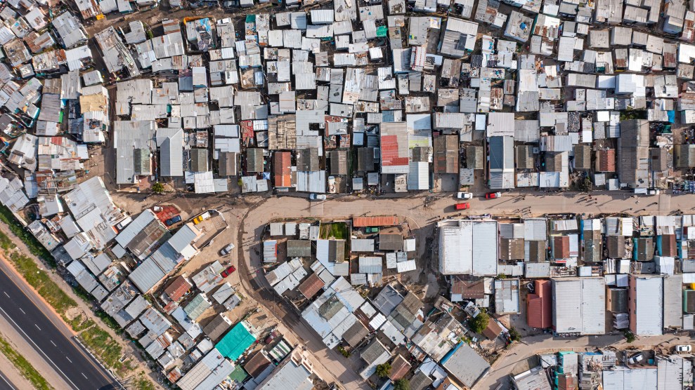
The scientists’ big finding is that forests and buildings along the coast have skewed radar maps, presenting planners with inaccurate elevation data. Lidar showed coastlines often lower than first realized. This has two important implications: the same amount of sea level rise will be able to reach much farther inland, and it’s going to happen a lot sooner than expected.
The scientists’ new lidar-based estimate predicts that roughly 482,000 square kilometers of land will be submerged with one meter of sea level rise, nearly triple the 123,000 square kilometers predicted by radar-based projections. That’s an extra Cameroon-sized chunk of Earth, currently home to roughly 132 million people, that will be underwater by 2100 under a high-emissions scenario.
The risk is greatest for river deltas in tropical regions where the land is flat, the population is often high, and the data tends to be old. With two meters of sea level rise, by around the year 2150 under a high-emission scenario, the Niger Delta in West Africa and Myanmar’s Irrawaddy Delta will have five times more land underwater than the older radar-based estimates suggested. The same is true for the Chao Phraya delta, which spans metropolitan Bangkok, Thailand’s capital of 11 million.
To Vernimmen, the recalculation means society needs to rethink some things. “There are huge construction projects underway in areas that really should not be built on,” he says.
The researchers made their elevation data set publicly available in hopes that governments take note of the new timeline, adds Hooijer.
Mir Matin, a remote sensing expert at United Nations University in Ontario who was not involved in the study, says these estimates could be made even more accurate by using airborne lidar—the type attached to drones or airplanes—rather than passive satellite-based readings. Though more accurate, airborne lidar is also more expensive, requiring pilots, planes, and planning.
Some rich countries and large cities have shelled out for airborne lidar surveys, but Matin says developing countries would benefit as well. Rich countries—responsible for the bulk of global warming—could cover the cost, he says. “At the end, climate change is a global phenomenon,” Matin adds.